

Day 15, Monday, July 30th: Kærby – Hvalsø
Weather: rain during the day, strong rear wind, dry and sunny in the evening
Kilometres cycled: 59
Route:
National route 4
Kærby, Svebølle, Jyderup, Mørkøv, Sønder Jernløse, Nyby, Tølløse, Hvalsø
This morning I want to leave around eight o’clock. I still have to pay DKK 15, - (about € 2,-) but I haven’t seen any signs of life yet and I don’t want to wake the owners, of course. Around nine o’clock (it’s raining, after all), I decide to ring the bell. A sleepy Mrs. Stavnskær opens the door and I tell her who I am and that I want to pay, and thank her for the hospitality, and that I really didn’t want to wake her. In contrast to her husband, she doesn’t speak English, but that is no problem. She puts a guest book in my hands and I have to write something in it. She waits beside me in her dressing gown and, sitting on my heels, I write a little story. Very short, as this squatting gives me cramp …
And the rain promised for today falls in buckets.
Around four o’clock, I come to Tadre Mølle, a watermill with a small restaurant. I drink a large mug of coffee, in truth a cup that cheers. The waitress shows me the toilet and to my joy I see that there is also a nature campsite here, with shelters. Although it is still early, I decide to stop getting myself wet and stay the night here.
I meet Niels in one of the shelters, with wife and daughter (and rabbit). I have a conversation with Niels' wife about music-making in Denmark and Holland. She is a professional pianist and teaches at the music school in Kalundborg. She once came to Utrecht for a master class at the Conservatoire.
A little after me, a young couple from Copenhagen arrives. We all sit around, drinking coffee, and the conversation is mainly in Danish, until Niels asks if I can mend a tyre. ‘Course, I say bravely, if you go on a cycling holiday, that’s the least you must be able to do. Why? Well, this couple has a flat on their trailer and doesn’t know how to mend it … Ai, ai. I make amends by offering to teach them. In the end, under my supervision, they mend the tyre and get my pump as a present for finishing the course (I had two, and they didn’t have one).
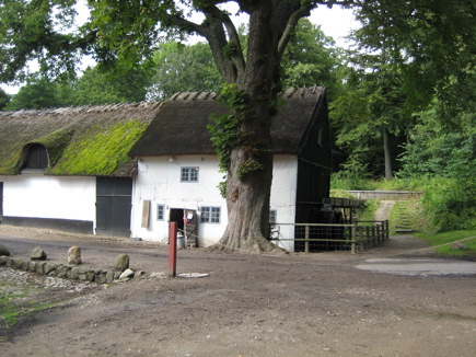
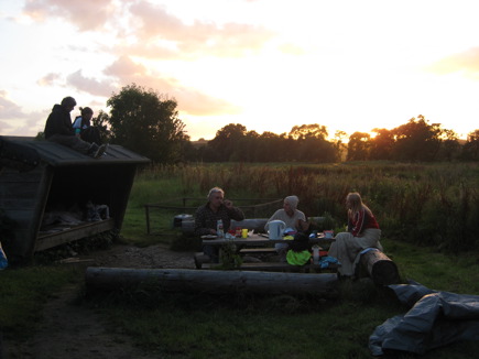
Tadre Mølle
Day 16, Tuesday, July 31st: Hvalsø – Bastrup
Weather: cloudy, bit of sun, strong rear wind
Kilometres cycled: 71
Route:
National route 4 / own route
Hvalsø, Lejre, Roskilde, Ågerup, Østrup, Veksø, Gangløse, Bastrup, Slangerup, Slagslunde, Gangløse, Bastrup
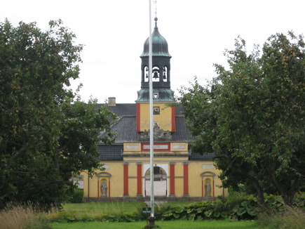 I don’t stay long in Roskilde, just look around on the bike.
The route today is not so interesting. I’m not on the official cycle route but consult the map for the shortest route to Helsingør, because I want to cross to Sweden tomorrow. I make a detour of 20 km. on a bad path through the woods to the camping site in Bastrup, which lands me with a broken mudguard.
Day 17, Wednesday, August 1st: Bastrup – Landskrona (Sweden)
Weather : sunny
Kilometres cycled: 73
Route:
Own route / Cycelspåret
Bike: Bastrup, Lynge, Lillerød, Hillerød, Asminderød, Kvistgård, Helsingør
Ferry: Helsingør – Helsingborg
Bike: Helsingborg, Rydebäck, Glumslöv, Landskrona
For years I have dreamt of visiting Sweden someday. Why? It appeals to my imagination: the country of Astrid Lindgren and Selma Lagerloff. So, if you are in the vicinity anyway …
Both Danes and Swedes like to visit. There is a ferry from Helsingør to Helsingborg every half hour that only takes 20 minutes.
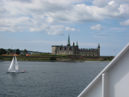
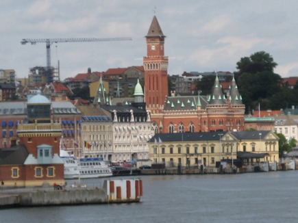
Picture left: "To be or not to be": Kronborg Castle in Helsingør is the setting for Shakespeare’s Hamlet
Picture right: Arrival in Helsingborg
Once in Sweden, I ask for information on cycle routes and camp sites at the tourist office.
A very helpful lady recommends the Cycelspåret which runs South along the West coast of Sweden. I can buy an (expensive) map but, she whispers, there are free maps as well, which are really better and also show the camp sites. Well, the free one, of course, which does very well, especially as the route is also marked along the way.
As for camping: you can camp anywhere or make use of a site. She advises me not to camp ‘freely’ because of road pirates: tourists who camp near a road risk being robbed. This, however, is denied by a Swedish male customer: “It’s not that bad, you can camp freely, so long as it’s not within sight of the road”. In any case, I don’t plan to camp ‘freely’ and I’m looking forward to a real camp site, complete with all the amenities.
The route is not very spectacular. The part along the coast is nice, but there are also many bits along the motorway.
But … I’m in Sweden, on my bike!!
I find a camp site in Landskrona. Here I learn that you have to have a camping card in Sweden to camp on a site. As I’m only staying one night in Sweden, the warden looks the other way: I may stay without a card.
I get a place on the travellers’ field, but I’m not the only Dutch person. Rather fun to speak Dutch again for a change.
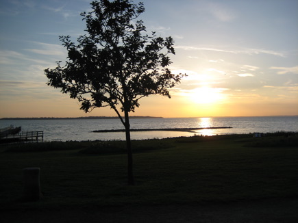
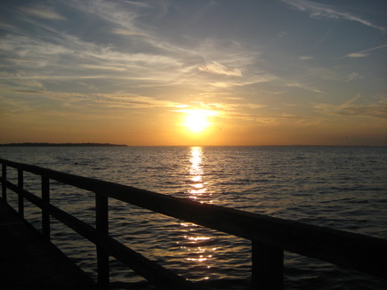
The camp site is on the coast. When evening comes, I go and sit on the landing stage to enjoy the sunset.
Day 18, Thursday, August 2nd: Landskrona – Vestamager Viltreservat
Weather: cloudy in the morning, sunny in the afternoon, rain in the evening
Kilometres cycled: 69
Route:
Cycelspåret / own route
Bike: Landskrona, Häljarp, Barsebäck, Löddeköppinge, Bjärred, Lomma, Malmö
Train: Malmö – Tårnby
Bike: Tårnby, Vestamager Viltreservat
Looking for information on Malmö, I find, to my amazement, a very negative piece in Trotter’s guide book: “ You may not feel much like hanging around for long in this big port and industrial city. That is just as well, because there is not much to see. A tip: go to the medieval town of Lund as fast as possible”.
I don’t understand this, Malmö is a beautiful city. Of, course, I haven’t been to Lund, which may be more beautiful, but an afternoon in Malmö is certainly worthwhile.
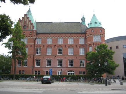
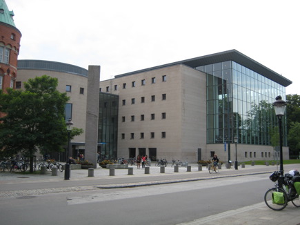
The Malmö library. The old building on the left. Joined to it, on the right, the new one.
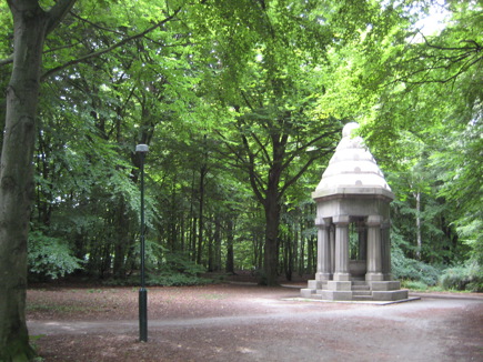
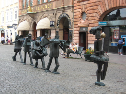
Pildammsparken and a pedestrian precinct Södergatan. In the same street, a “brass” band
At the end of the afternoon, I return to Copenhagen by the bridge that links it to Malmö. Since one cannot walk or cycle over it, the train remains the only option. Like the Deutsche Bahn, a cyclist-friendly train.
I get to talk to a Danish woman from Copenhagen who has been to Malmö to shop. She tells me that she grew up in Tårnby (below Copenhagen) and advises me to visit the little town of Dragør.
Always handy, information from the locals.
Day 19, Friday, August 3rd: Vestamager Viltreservat (Copenhagen) – Glostrup (Copenhagen)
Weather: cloudy/sunny, strong wind
Kilometres cycled: 62
Route:
Own route
Vestamager Viltreservat, Søvang, Dragør, København, Glostrup
2 flat tyres
I wake up in the middle of the night because of a scraping noise outside the shelter I am staying in.
I am lying in the inner tent, which I have put in the shelter. There is gravel in front of the shelter and I can clearly hear footsteps on it, close by.
To tell the truth, I am rather frightened and my heart is doing overtime. I decide to be brave and have a look. This seems to me the most sensible thing to do, because: 1. If someone means harm, that will happen anyway, whether you have a look or not. 2. If you live to tell the tale, it is quite nice to know who your enemy was. And 3. Maybe I shall be reassured by having a look and if I don’t, and nothing happens, I will stay awake all night, wondering what is creeping round my tent. Extraordinary, the things that go through your head in 2 seconds. After all that, I pick up the torch and carefully open the zip of the tent. I turn the torch on and am suddenly looking straight into the eyes of …a deer!
It is standing only two or three metres from me and is looking straight at me (or rather, at the light of the torch). I look at it in awe. My heart is racing again, or rather, still, but not from fear this time. Wow, this is fascinating! I am not really thinking about how to react and want to greet him (or her) nicely, so I say ‘Hej’ (Danish for hallo). It turns round and walks away slowly.
I zip the tent up again and lie down, very impressed. A little later, I again hear footsteps. They are lighter this time and I take it for granted that it must be an animal again, only smaller. Bravely (we learn fast), I get the lamp, unzip the tent and look out. At the same time, I see a fox slipping away. Pff, am I glad that both animals did not visit me at the same time? As they do not like each other very much, that would have caused quite an upheaval.
What an fantastic experience!
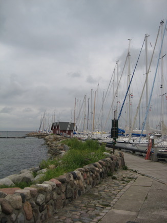
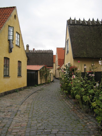
Near Copenhagen, on the coast, lies the idyllic little harbour town of Dragør. Although it is a bit out of the way and the weather rather sombre, it is well worth it.
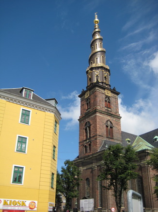
At the end of the morning, I arrive in the Christianshavn district of Copenhagen. The weather is getting better and I decide to climb the spiral tower, which looks very impressive from a distance: the For Frelsers Kirke.
The district of Christianshavn (10.000 inhabitants) was built on the island of Amager at the instigation of King Christian IV from 1618 onwards. With its canals and right-angled streets, it reminds me of our own capital city.
The district is linked to the centre of Copenhagen by the bridge, Knoppelsbro. Christianshavn is also known from the novel by Peter Høeg: Froken Smillas fornemelse for sne (Smilla’s feeling for snow).
There have never been serious fires in Christianshavn, so that many houses look exactly as they did 400 years ago, when they were built. Some are in bad repair, but others have been beautifully restored and colourfully painted. There are often boats lying in front of the houses on the canal, making the district even more colourful.
I go into the church and the man at the desk looks at me and says in English (do I look that foreign?), I saw you this morning! Oh dear, what a coincidence. Of course, Denmark is small, and I am probably quite a conspicuous figure. But Copenhagen is large and a lot of conspicuous figures are walking around there. I don’t believe a word of it.
He is quite sure; this morning he saw me taking a photo of the Utrecht Alle, which is near where he lives. Hm, no mistake, that was me.
I am subjected to a waterfall of questions: where do you come from, how long have you been travelling, what have you got with you (eh…?). Meanwhile, I can hear someone playing the carillon and ask boldly whether someone is playing on a practive keyboard here (it sounds like a practice keyboard and I had heard nothing outside). Ha, now it is his turn to look astonished.
According to him, I must be an excellent carilloneur myself to recognise the difference and that is not unusual, sinds I come from the Netherlands. Well, sir, I am not a carilloneur, but I work at the Dutch Carillon School in Amersfoort and am going to start lessons in September. “Ah…well now, sit down, have this chair, do you know Boudewijn Zwart?” “Not personally, but I know who it is”. He points to a concert poster. “And do you know Arie Abbenes and Bernard Winsemius?” “ Yes, until recently, they were teachers at the school”.
I am given coffee and he tells me about the carillon in the For Frelsers Kirke. It is being repaired for three years and the concerts will be given in other towers in Copenhagen.
Altogether, a friendly visit, that also provides me with a free ticket for climbing the tower.
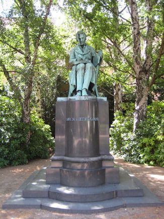
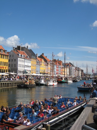
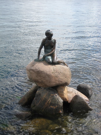
Click here for more pictures of Copenhagen
Day 20, Saturday, August 4th: Glostrup (Copenhagen) - Holtug
Weather: sunny, warm
Kilometres cycled: 63
Route:
National route no. 5
Glostrup, Greve, Køge, Strøby, Egede, Magleby, Holtug
2 flat tyres
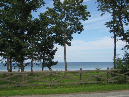 I wondered whether I should go all the way to Stevns Klint, or take a short cut. Luckily, I chose the former: it gave me a couple of very nice days.
At the end of the afternoon, I put my tent up near Flagbanken. This was originally a military area and is one of the highest points at Stevns Klint
Stevns Klint is a limestone cliff, 22 km long and 41 metres high, formed by gradual erosion of the layers of limestone, chalk and flint by the sea. In the summer, the sea is a beautiful blue, through reflection of the cliffs. There are trees growing on the top.
These cliffs are difficult to find, as there is hardly anything to be seen from the land, but there is a path along them, Trampenstien. This is a special path, as the 52 landowners have made an agreement with the Stevns authorities, giving hikers permission to walk over their land.
One or two farmers did not agree to this and then the path makes a detour. It is dangerous to walk along the cliffs in winter because of falling debris.
Stevns Klint runs from Bøgenskov Havn to the north of Stevns to the port of Rødvig in the south. Its name comes from the fact that it looks like the bows of a ship. It is said that a king, “Klintekongen”, lives in one of the caves in the cliff.
Here I meet Jørgen and Hanne. They are doing a two-day hike from Køge to Rødvig where they live.
I ask them how best to cycle along Stevns Klint but this appears to be impossible. They suggest that I join them on the walk next day, leaving my things here. They can then bring me back from Rødvig by car.
Hm, why not? Sounds nice, something different for a change.
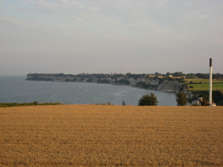
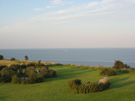
Camp site near Flagbanken with a view of Stevns Klint from a viewing tower. Officially, there is only room for two tents and there is a shelter, but this is a haven for hikers and tents are put up everywhere
Day 21, Sunday, August 5th: Holtug – Rødvig
“Day of Rest”
Weather: warm, sunny
Walked 14 km with Hanne and Jørgen
Route:
walker’s route along Stevns Klint
Holtug, Tommestrup, Højerup, Rødvig
Today’s photos are by Hanne and Jørgen as well as me
As Jørgen is going to Lapland for a fortnight’s hike in a few weeks, on his own, he must practise walking with a heavy load. Both Hanne and Jørgen have large backpacks, while I just have a small bag with some lunch and water. My offer to take something for them is refused; after all, it’s my day of rest today
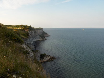
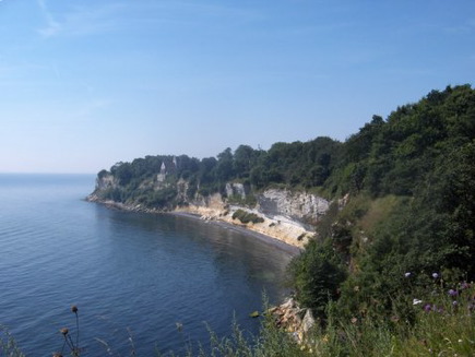
Stevns Klint
Click here for the beautiful pictures of the walker’s route along Stevns Klint
Jørgen is looking forward to showing me the view from the top of the lighthouse but when we get there, it turns out to be closed for repairs.
A little further on, there is a small shed. Jørgen says there are marines in there every day, looking out to sea for anything unusual. This dates from the Cold War but is still carried on.
Sounds like a strange job nowadays.
In spite of the fact that there has been no enemy ship all day, the men are friendly. Jørgen tells them that they have brought a Dutch tourist along, who has come specially to see the view from the lighthouse. Whether or not they believe him, Jørgen is given the key and we may go up. It is at our own risk, because there are loose cables lying around on which we could trip up.
On March 16th 1928, at 5 o’clock in the morning, there was a landslide round Højerup. That happened quite often, but this time was special: the choir collapsed into the depths.
The church was built round 1250 and from 1600 on, the edge of the cliff came nearer every year through sand shifts. According to local legend, this happened every Christmas Eve.
The church was no longer used after 1910, as one feared it might collapse at any time. Yet it took another 18 years before it became a fascinating attraction. During the three days after the accident, more than 40,000 people came to see the half-destroyed church.
Shortly after, it was decided to strengthen the church to prevent further collapse. Today, the church sticks out above the edge of the cliff. A balcony has been placed
in the ‘hole’ in the wall where the choir was, giving a beautiful view over the Baltic Sea.
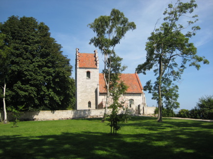
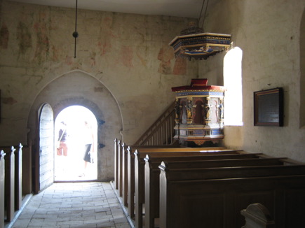
Højerup gamle Kirke
Hanne lives in a bungalow in a holiday park and Jørgen in a village 25 km away.
They invite me to stay to supper and for the night at Hanne's place. We fetch my bike, tent and everything else by car and do some shopping
After supper, we take a “dip” in the Baltic Sea, brr … cold, but very refreshing.
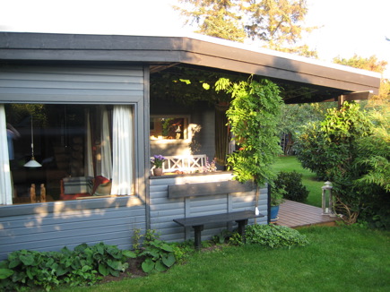
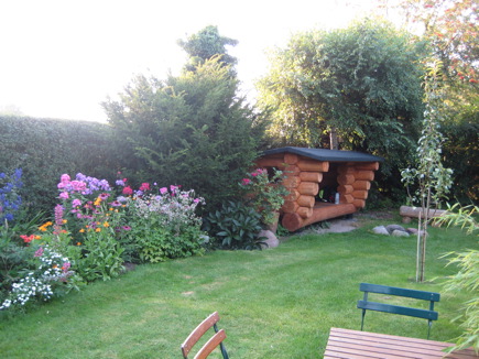
Jørgen made a shelter for Hanne’s birthday, and I slept there that night.
